TREX Day 8: Thermal camera
By James Pruegsanusak ‘19
With the forward looking infrared (FLIR) thermal camera attached on the drone, Prof Ben Kocar drove David, Josh, Meghan and I to Mr. Ha’s farm again today for more data collection, both on the ground and from the air. The rest of the team went to retrieve the sensor boxes we placed along the coast yesterday. They also put a PM sensor and a SO2 sensor (from last year) on the top of their car for “plume chasing” to map out the data with GPS location and time of the day.

Chang put on two sensor boxes on the top of the car.
Today was a cloudy day, with only a few drops of rain, so it was good for flying the drone and collecting soil and corn samples. First, we flew a test flight to make sure that the FLIR thermal camera for measuring temperature actually worked. Unfortunately, the NIR (Near Infrared) camera for evaluating the crop health currently didn’t work, so only RGB and temperature data were available. We flew the drone three times on the same path, spacing 1.5 to 2 hours between each flight, aiming to see how the crop’s temperature varies spatially and temporally. We also had virtual reality goggles to view the thermal camera in real time, though the signal was sometimes noisy.
 David wearing the goggles to view the FLIR thermal camera image in real time.
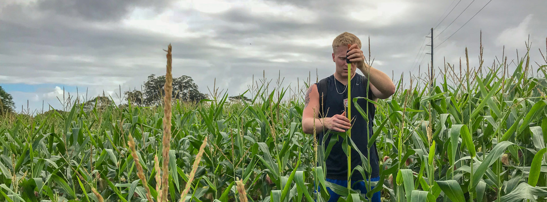
In between those flights, we walked into the rows of corns, following the GPS coordinates we marked earlier. These locations were chosen by looking at the NDVI (Normalized Difference Vegetation Index), which were calculated from the NIR images. In addition to scooping soil into Ziploc bags, we measured soil temperature and the corn tree’s height at each location.

Collecting soil sample from 0 to 15 cm from the surface.

David walking between the rows of corn, following the GPS tracker to a chosen location.

Josh measuring the height of corn tree. We took four measurements at each location.
After coming from the first round of data collection, Ben gave us a surprise. The car’s battery was dead. It was at the expense of a fast-draining drone battery being fully charged again. (Each drone battery only lasts for about 25 minutes of flying.) While waiting for the rescue, I flew the drone manually for a couple minutes, trying to get images of the crop from a lower height.

The white car coming to jumpstart the dead battery of our red car. This image was taken with the drone (DJI Phantom 4).
The data collection phase has come to an end. Here comes data analysis. After dinner, each of us worked on different tasks, from organizing samples to processing data. Working on stitching images from thermal camera, I found that it was tricky and there were some problems I didn’t anticipate. So far, I’ve found some workaround and below is a preliminary result. Next steps are to read off the temperature values from these colors and to compare the results of the three flights (same area, different time).

A stitched thermal image of the corn field from (parts of) the first flight around 12 PM.
Every year, a group of MIT students and professors travel to the Big Island of Hawaii to gain fieldwork experience through TREX (Traveling Research Environmental EXperiences). The first TREX trip was held in 2000, and since launching has taken students on research activities in domestic and international settings. For more undergraduate opportunities, click here.